There is currently a major weather system severely impacting the state of Louisiana. Tropical Storm Barry began dumping several inches of rain, which led to severe flooding, in the state earlier this week.
As of today, the storm has started to strengthen, and it hasn’t even made landfall. It is said to be producing winds of 40 mph and the storm itself is moving at about 5 mph.
Weather experts predict that the storm will make landfall on Saturday morning, and by that time it will be a hurricane producing winds of up to 74 mph.
Because the system is moving so slowly, this causes it to stay around the same place for a longer period of time. This is why the area is seeing so much rain, that has been described as turning streets into lakes.
The mayor and town council of Grand Isle, Louisiana has asked all residents to evacuate ahead of what’s to come.
“We are expecting a rainfall total that can range from 6″ to 10″,” officials said in a statement. “We will be experiencing unusual high tides that will range more than 3 feet above ground.”
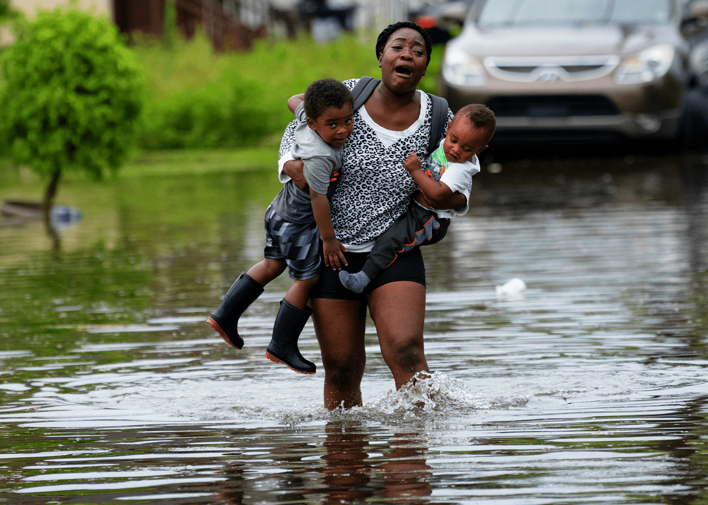
New Orleans saw up to 9 inches of rain just yesterday as the outer edge of the storm hit the area. Photos have been circulating of entire neighborhoods being submerged and residents seeking higher ground.
“I am evacuating. The water levels were too high for my comfort, and my car nearly flooded,” New Orleans Resident Dannie P. Davis told CNN on Thursday. “I haven’t seen this much rain and flooding before a hurricane in a while. While the evacuation isn’t mandatory, I am leaving as a precaution. Who knows what’s to come, how and whether the city will able to handle it.”
Louisiana Governor John Bel Edwards has already declared a state of emergency and urges those around the state to begin preparing now if they haven’t already.
“This is going to be a Louisiana event with coastal flooding and heavy rainfall potentially impacting every part of the state,” Edwards said.
We will keep you updated as this storm progresses in the next few days.